

At Geotab Connect 2026 in Las Vegas, Geotab unveiled the next phase of its telematics roadmap, positioning AI-powered video, higher-precision vehicle intelligence and satellite-enabled asset tracking as key priorities for Australian and New Zealand fleets.
The message from the global launch was clear: telematics is evolving from vehicle tracking into what the company described as an “operational brain” capable of converting complex vehicle data into practical, near real-time insights.
David Brown, Associate Vice President, APAC, Geotab, said fleets in this region operate in uniquely challenging conditions.
“Australian and New Zealand fleets operate in some of the most demanding conditions in the world. This next wave of innovation is about turning connected vehicle data into near real time intelligence that fleets can actually use to prevent incidents, sharpen decision making and maintain visibility across vehicles and critical assets, even in hard to reach areas,” Brown said.
For Fleet Managers balancing safety, compliance and cost pressures in 2026, the roadmap centres on three areas: AI-powered video safety, next-generation hardware, and improved visibility of non-powered assets.
AI-powered video safety: GO Focus Pro
A headline announcement was GO Focus Pro, an expansion of Geotab’s video telematics portfolio designed to deliver 360-degree visibility with predictive risk detection.
The system combines surround video coverage with in-cab AI alerts to identify potential risks before an incident occurs. For heavy vehicle operators, a key feature is a zero-latency backup monitor, providing a near-instant video feed to assist with reversing and docking — activities that remain high-risk for low-speed incidents in depots, worksites and last-mile environments.
For organisations with growing liability exposure and higher insurance scrutiny, this approach signals a shift from post-incident review to proactive risk mitigation.
Next-generation intelligence: GO and GO Plus
Geotab also introduced a re-engineered version of its flagship GO device alongside the new GO Plus telematics device.
Built on a new architecture, the devices are designed to support faster AI processing and higher-integrity data streams. This is particularly relevant for mixed fleets managing internal combustion vehicles alongside battery electric vehicles.
Key enhancements include:
- GO: Native Bluetooth connectivity and enhanced tamper protection with last-gasp alerting
- GO Plus: Satellite-ready tracking capability and an integrated Wi-Fi hotspot to support data continuity for incident reconstruction and operational transparency
For fleets transitioning to EVs, reliable diagnostics covering fuel tracking and EV performance data remain critical for whole-of-life cost modelling and compliance reporting.
Extending visibility beyond vehicles
Beyond powered vehicles, Geotab introduced the GO Anywhere and GO Anywhere Plus asset trackers, targeting trailers, heavy equipment and other non-powered assets.
The GO Anywhere Plus model introduces the potential for satellite connectivity in Australia, merging mobile and satellite networks in a commercial IoT device. For fleets operating in regional and remote areas, this aims to close coverage gaps without the cost burden traditionally associated with satellite-only hardware.
For local government and utilities operating plant and trailers across wide geographic footprints, this capability may address long-standing concerns around asset utilisation and loss.
From tracking to operational intelligence
For Procurement Managers and Fleet Coordinators, the announcements at Geotab Connect 2026 reflect a broader industry shift. Telematics is no longer positioned solely as a compliance or tracking tool, but as an integrated platform designed to influence driver behaviour, asset utilisation and sustainability outcomes.
The practical question for fleets in 2026 will be how these tools integrate with existing systems — and whether the promised near real-time intelligence translates into measurable improvements in safety, productivity and cost control.
- Five questions Fleet Managers should ask their FMO — and how AI can answer them
 Fleet Managers have always asked their Fleet Management Organisation for answers about cost, utilisation, replacement cycles and risk. The difference is that those answers have traditionally required a report request, a spreadsheet, a data analyst and sometimes several follow-up emails to clarify what was really needed. Summit Fleet Leasing and Management is using its AI
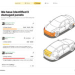
 - DingGo launches AI repair estimating platform for dealerships and repairersDingGo has launched Crash Intelligence, an AI-powered platform designed to estimate the cost of minor vehicle damage from a small number of photographs. The Australian technology company says the platform can provide an estimated repair cost within seconds, giving dealerships, service departments and repair businesses a faster way to assess dents, scratches, scuffs and minor
- If I See It, I Can’t Unsee It: The Human Challenge Behind Fleet DataTelematics technology has become commonplace in fleet operations, but according to industry leaders speaking at the AfMA Fleet Conference, the real challenge is no longer collecting data — it’s getting organisations to do something with it. During a panel discussion moderated by Chris Martin, Senior Manager, Solutions Engineering APAC at Geotab, fleet leaders explored how
- Telematics is becoming the evidence base for fleet cost reduction—not just trackingTelematics is shifting from a vehicle-tracking tool to a core source of evidence for Fleet Managers looking to reduce costs, improve utilisation and make difficult fleet decisions with greater confidence. Chris Tulloch, President, Custom Fleet, said connected vehicle data is now central to the company’s Strategic Advisory Services work, particularly where clients are trying to
- The Fleet Manager of the Future: Data-Driven, Cross-Functional and Policy-LedThe role of the Fleet Manager has evolved considerably over the past decade. Once centred on procurement, maintenance scheduling and compliance, fleet management now spans cost control, safety, risk, sustainability and operational performance. Expectations have increased, scrutiny has intensified and vehicle complexity continues to grow. According to Shaun Janks, Co-Founder and Chief DingGo at DingGo, the